NCICD Embankment Project Recontinued to Tackle Tidal Floods
Reported by Aldi Geri Lumban Tobing | Translated by Nugroho Adibrata
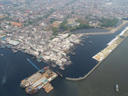
The Jakarta administration decides to continuously develop the National Capital Integrated Coastal Development (NCICD) coastal embankment along the coast of the capital as tidal floods mitigation in the coastal area of North Jakarta. It has been carried out through the Water Resources (SDA) Agency since 2016 to 2019 and then recontinued in 2021 with a total target of 790 meters.
We will prompt stakeholders who live in coastal area to help us in the process of embankment development to protect Jakarta's coastal areas
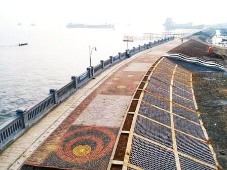
NCICD is a national strategic project to build a coastal embankment along the Jakarta coastline. Besides tackling tidal floods, its development is executed as an effort to safeguard and revitalize northern coastal area of Jakarta, as well as improve the environment. Thus far it is stagnant by high tides that occurred on Friday (12/3) in several areas such as Jalan Lodan Pelabuhan Sunda Kelapa, Jalan RE Martadinata, Tanjung Priok, Muara Baru, and Si Pitung Marunda area. It occurred in the morning from 7 to 11 AM, and began to recede in the afternoon until the evening.
Nevertheless, the embankment will keep being continued in collaboration with various parties, especially stakeholders whose activities are in direct contact with the NCICD embankment trace. "We will prompt stakeholders who live in coastal area to help us in the process of embankment development to protect Jakarta's coastal areas," explained SDA Agency Head, Yusmada Faizal, at SDA Agency Office, Central Jakarta, Tuesday (12/7), as quoted by Jakarta PPID's press release.
Sea Giant Wall in Jakarta Keeps Being AcceleratedAs for the information, tidal floods occurred after sea water overflowed through the embankment as the current height of the existing embankment cannot withstand tidal waves, especially if the sea level (TMA) exceeds +240 PP. The average height of the inundation caused by the tidal flood was as high as 20-50 centimeters.
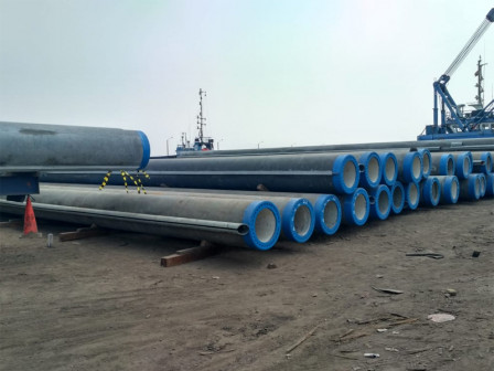
Aside that, the agency also planned to develop 2 coastal polder systems, namely Kamal and Marunda polders, where it consists of sluice gates, pumps and reservoirs. These polders will later be integrated with the NCICD embankment, which is currently still in progress.